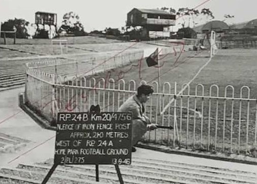
After the Second World War, there was a pressing need for new maps. Ordnance Survey (OS) surveyors used triangulation points in the country and revision points (RPs) in towns as reference datums. These known spots were often on the corners of buildings and other immovable features, which could be fixed to centimetre accuracy. Being able to find the RPs for future map updates was important so they were recorded by taking photographs. The exact position of each RP was shown by an arrow, held by a surveyor and pointing to it.
A 1946 OS survey of Central Park produced 58 photos of RPs and they are now in The Box’s records. The ones included here are reproduced with permission of The Box, Plymouth, and they provide an impression of how the park looked in 1946.


