When Mawson designed the park in 1928, he made the following observations about the area’s water resources and how they could be used to provide amenity. The small water course which is mentioned near the social centre is shown on a 1933 map rising near the present clock tower and flowing westwards towards Alma Road.
The Wild Garden
Two areas of the Park came under this heading, first that surrounding the small water course near the social centre, and second the deep valley and bank on the Eastern boundary. In both of these water and rock work will play a great part. Small miniature lakes, running streams and cascades and falls make most pleasing features, and skilfully handled contribute very much indeed to the fundamental purpose of these areas. The gurgle of a waterfall, the lazy flow of a stream, the placid peace of a pond or miniature lake are all very conducive to that feeling of peace, repose and relaxation which such a garden should produce, and a complement to the more formal and busy sections of the Park. The area near the social centre is planned as a small rocky stream and rock garden, always a delightful feature in that they present great opportunities for masses of alpine plants with their wonderful colouring.
The glen is planned on much bolder lines. The present stream being contaminated with sewage, ought to be culverted. The various springs, however, which find their way into it ought to be collected and used, together with the surface drainage, to form a new stream. Near the entrance from Barn Park Road it is proposed to back the stream up, forming miniature lakes surrounded by suitable aquatic plants. As the stream proceeds down the glen, the levels will allow of it being broken up into small cascades and pools, along the banks of which native ferns would find an ideal home.
A date has still to be identified for the culverting work. It must have been completed prior to 1981 as the City Engineer did not identify sewage contamination as an issue in his report. The culvert is shown on plans as built of bricks which suggests it was completed before the outbreak of the second world war; i.e. between 1928 and 1939.
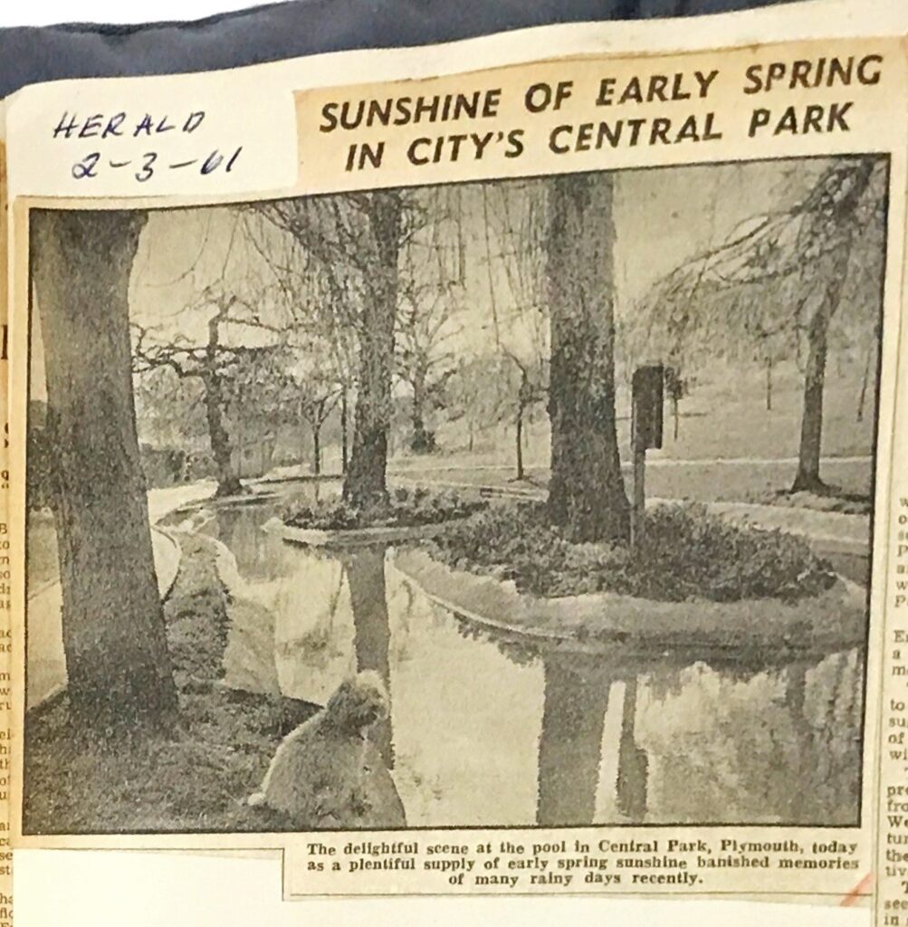
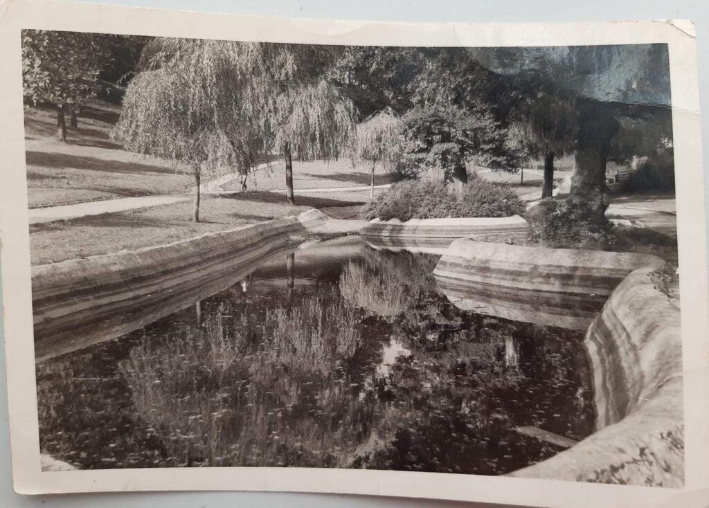
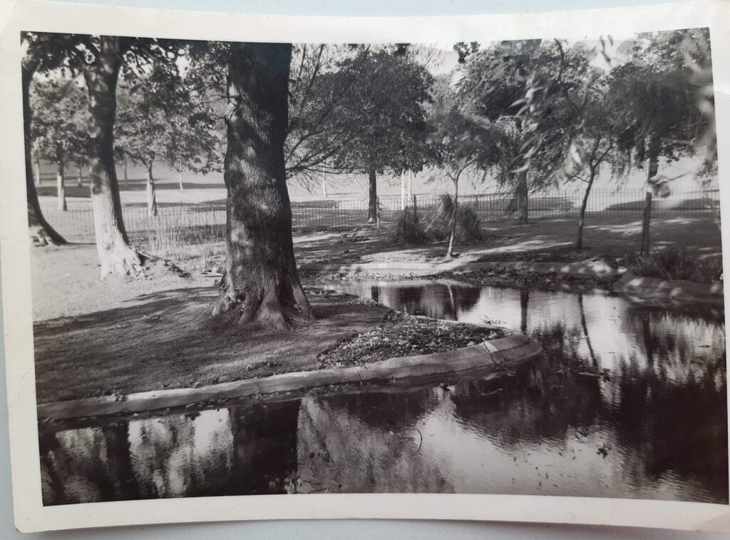
Also, by 1939 two ponds had been constructed; one near the Barn Park Road entrance and the other close to the boundary with Ford Park Cemetery. The ponds do not appear on the 1933 map but a newspaper report from 1946 shows that they must have existed before the war so, on present evidence, they are provisionally dated to c1937, the same year that trees were planted on Coronation Avenue.
Tragically, a small boy drowned in the pond by Ford Park Cemetery in 1946. The Evening Herald reported on 15th March 1946 that the pond was 3ft 6in in depth, had only a small concrete rail around it although, before the war, there was a paling which had been tampered with and finally taken down.
The Ford Park pond appears to have been fed by a spill that flowed through the Valley from the old reservoirs which, in turn, were supplied by residual flows from the old Stonehouse Leat. This arrangement continued until about 1970 when the reservoirs were filled in and the Stonehouse Leat fully culverted.
(The Box accession reference 2732/14)
The Barn Park pond was fed by seasonal springs which were collected by natural channels on the southern side of Coronation Avenue. However, no attempt appears to have been made to collect pathway run-offs as envisaged by Mawson. It is remarkable that the 1981 City Engineer’s report does not mention water issues, presumably because the springs were not considered significant and, except for the pond at Barn Park, the other main watercourses had been culverted by then.
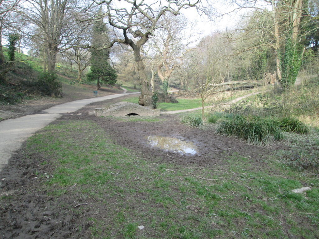
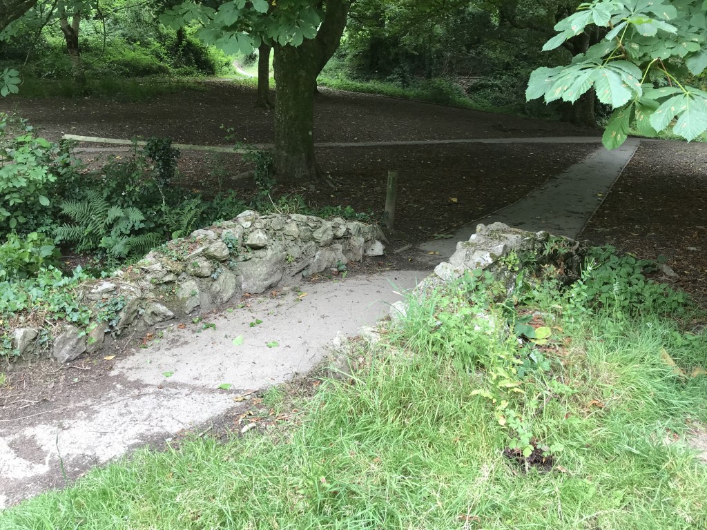
Associated with the former Valley stream are two footbridges, one near the north west corner of Ford Park Cemetery and the other where the stream entered the Ford Park pond. The map evidence is that they were constructed at the same time as the ponds; that is c1937.